Indigenous planning through participatory mapping
By Alexandra Lamiña
Introduction
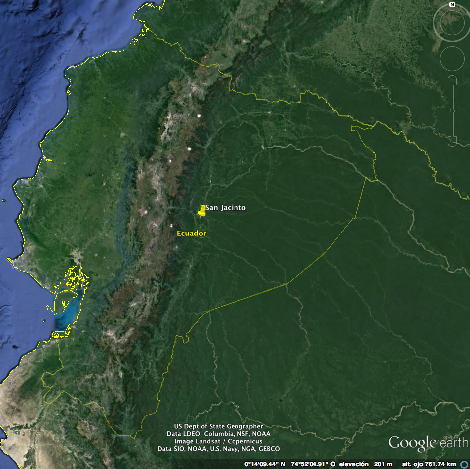
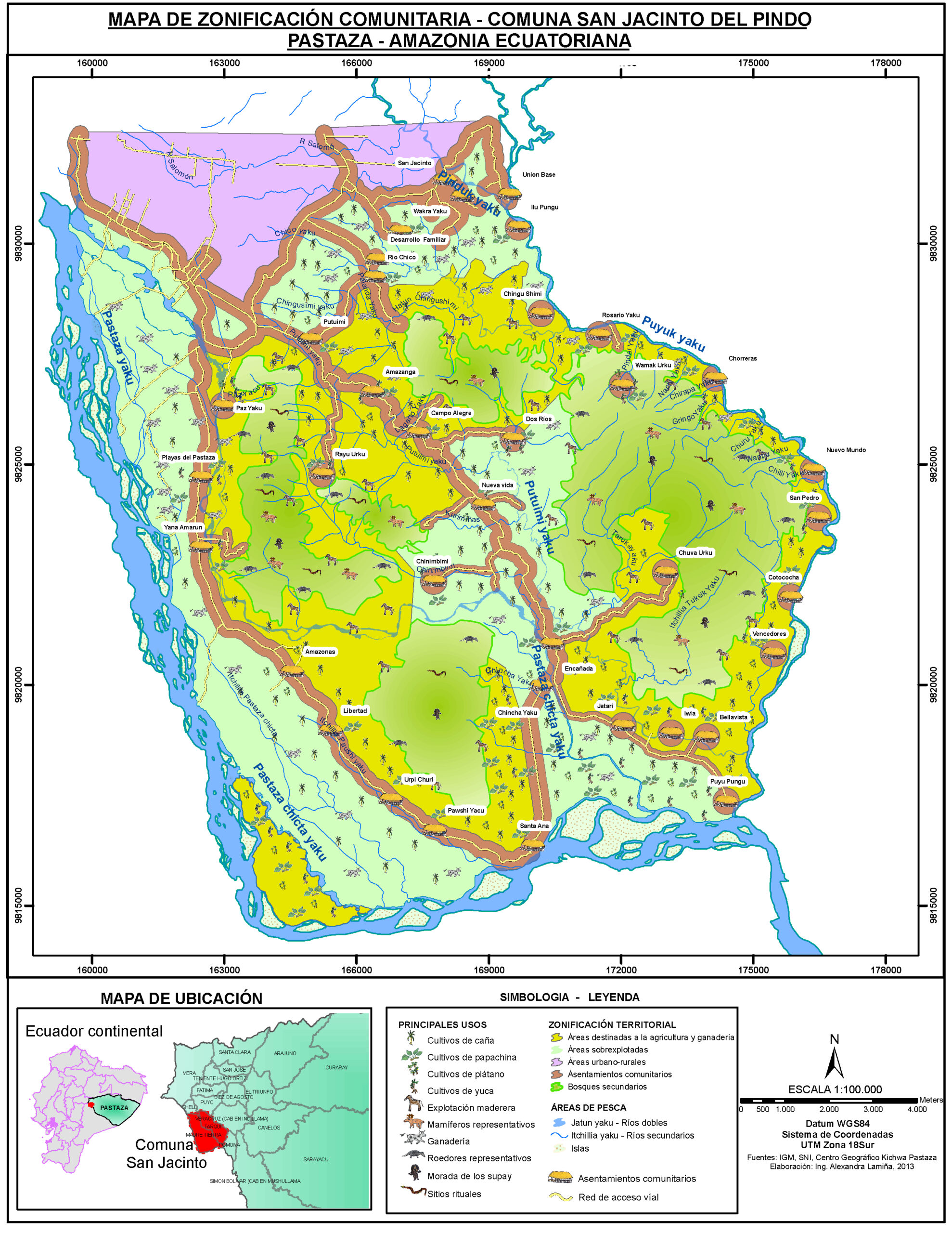
In the west-central region of the Ecuadorian Amazonia, the Kichwa Indigenous Commune of San Jacinto has been facing repeated modernist planning experiments aimed at poverty alleviation. At the same time, the San Jacinto territory remains fragmented due to processes of colonization, resource extraction, urban expansion, and politics of rural development. In February 2012, while I was working as a State-NGO subcontracted geographer, I conducted land use mapping in San Jacinto, using GIS modeling to quantify land-use changes in order to prescribe best practices for land recovery and poverty alleviation through agricultural projects.
However, as I explained the scientific approach I was using in order to represent Amazonian land-use and land-cover changes (ESRI, sn; SENPLADES, 2016), the indigenous Kichwa sharply questioned why I was ignoring their capacity to plan for their own communities. They explained their indigenous planning tradition, which is based on quotidian practices to manage the plurality of the Kichwa space using their knowledges and, demonstrating how my scientific production of space reinforced a history of colonialism and modernization whereby the Kichwa indigenous planning is systematically excluded from dominant thought. What I conceived of as a simple project of land-use planning, the Kichwa saw as the personification of state efforts to remake indigenous grabbed lands.
Analysis
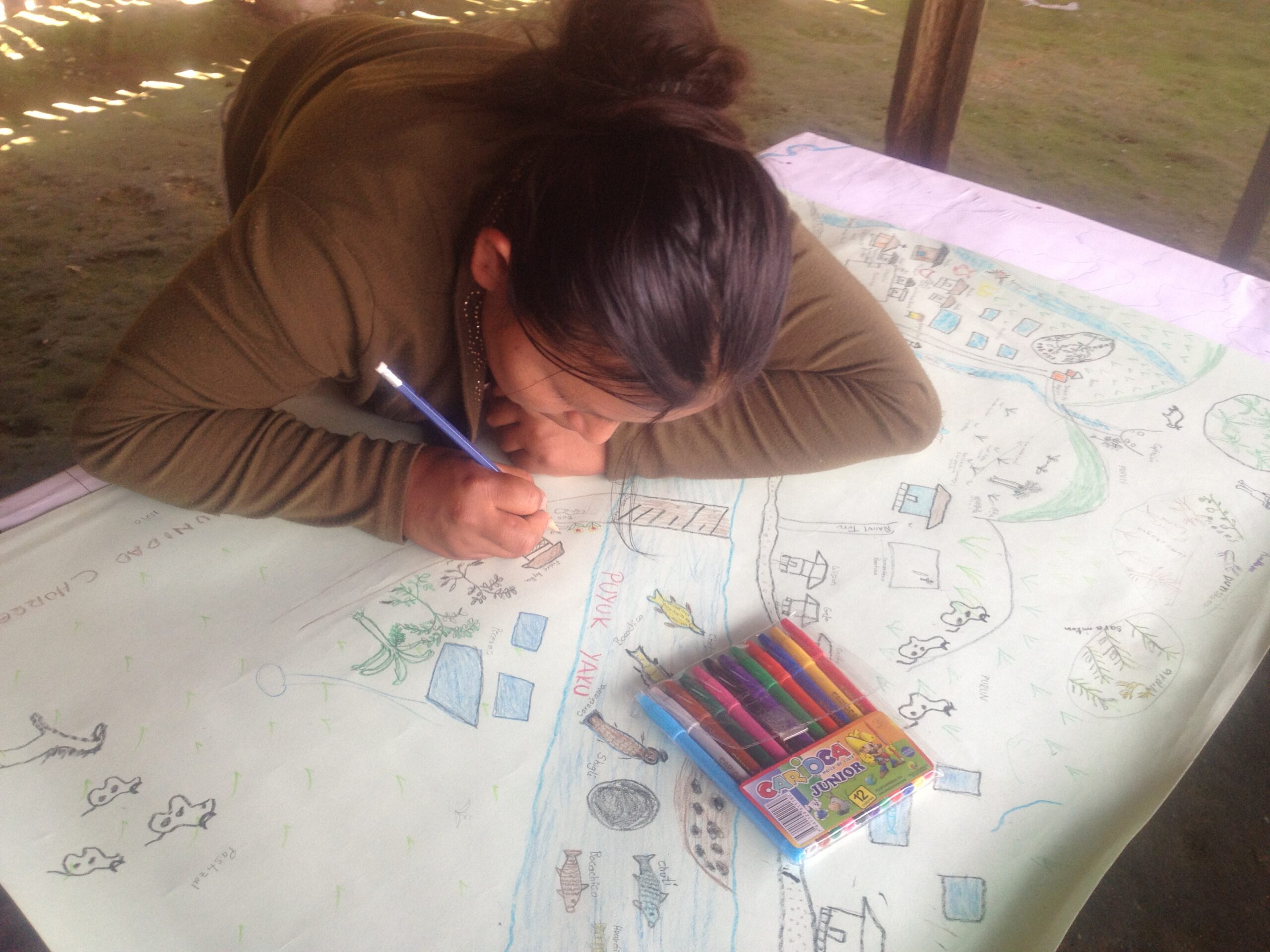
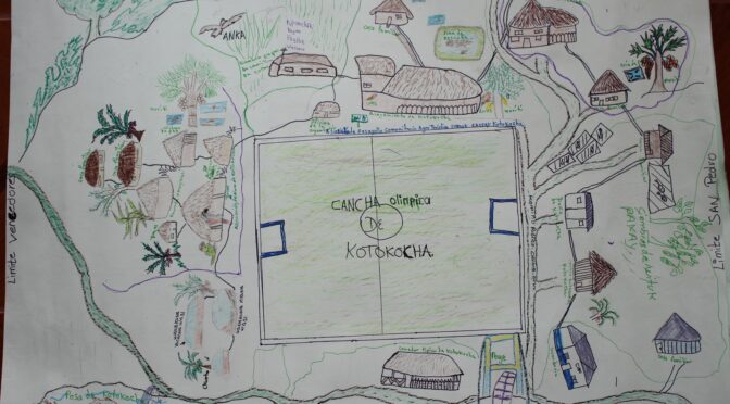
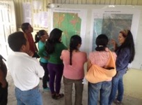
“Are we being the actors in mapping or being the subjects mapped?” was the dilemma that Kichwa people looked for elucidating. There is no simple way to answer it. However, considering that there is a shared role in the decision-making during the planning process, this process must rely on more generative and sensitive support beyond the ongoing colonialism context. Committing me during the “process” instead of only making “products” was my motivation and strategy for contesting mainstream planning. Informed then from my previous experience of work with indigenous people; participatory mapping was a suitable solution. This method can be flexible and adaptable to encounter the indigenous philosophy while drawing, chatting, and sharing with the families. Disregarding the aesthetics and accuracy of the map, I paid particular attention to the narratives and affects that couldn’t be represented on the map: ritual beings and their memories on the space. I then noticed the “spatial pluralism” in the maps, which can connect more than human elements. This plurality of the space comes from an indigenous ontology, which is rejected by Western planning, due to such pluralism cannot be captured, measured, and predicted in the same way that I did when using GIS in land-use changes.
Seeing my previous experience in retrospective and linking it with my current academic formation, I understand that Western planning embraces rational schemes, patriarchal goals, and colonial roots that Indigenous Planning, as a body of work, aims to challenge. Indigenous planning is based on decolonial, collective thinking and praxis, recognizes indigenous cultural identity, and proactively integrates indigenous people into the self-management of their ancestral territories, knowledge, resources, and communities (Walker, Jojola, & Natcher, 2013). This approach shares the critical epistemological assumptions of postcolonial and feminist planning by incorporating new theories, actors, methodologies, and knowledges in planning, while critically assessing the burden of coloniality (Porter, 2006, 2010; Sandercock, 1998, 2004; Sweet & Ortiz Escalante, 2015). In the case of San Jacinto, it was evident that indigenous knowledges have their own geographies and forms of governance, which are resisting traditional state planning praxis.
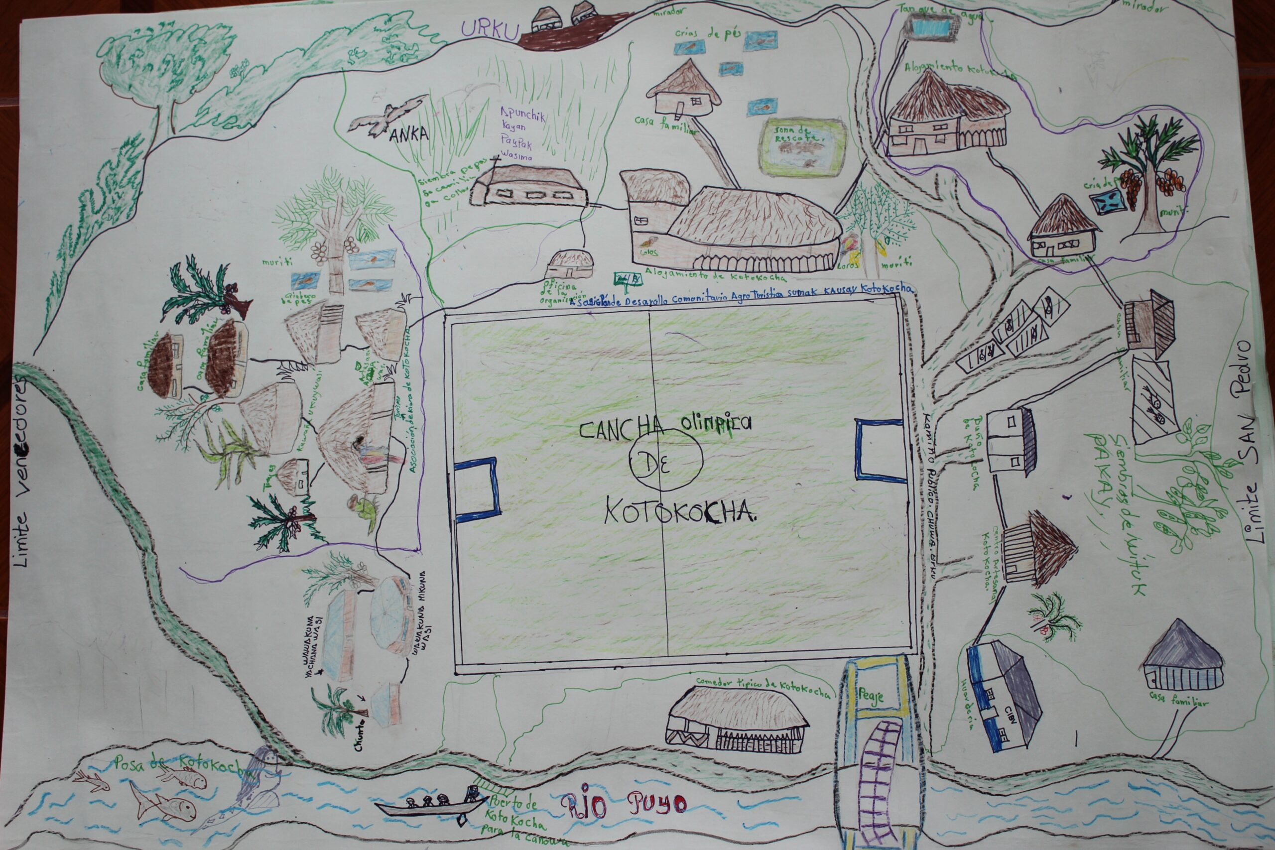
My critical approach to indigenous geographies is informed by post-representational cartography, which holds that maps are not finished or stable products but rather always in a process of becoming (Kitchin & Dodge, 2007; Kitchin, Gleeson, & Dodge, 2013). The case of San Jacinto shows that indigenous counter-cartographies are frequently co-produced and represented through narratives, stories, rituals, and memories but such performative processes are not commonly recognized as cartographic traditions (Johnson et al., 2005). By being attentive to the power of indigenous narratives during the mapping process, I realized that ‘multiple literacies’ allow indigenous people co-produce different ways of spatial representations (Johnson, Louis, & Pramono, 2005). I also understood that geospatial technologies may be suitable for indigenous geographies when used in an “informed way,” especially when the participatory process is democratic (Pearce & Louis, 2008) and allows the narratives that inform the maps and the mapping process to emerge (Caquard & Cartwright, 2014).
Implications
My personal experience demonstrates that external professionals can work with residents to write alternative, “insurgent” planning histories (Sandercock, 1998). The Kichwa planning traditions highlight the importance of retaining “distinct tradition, history, contemporary identity, and practice as indigenous planning” while encouraging the “capacities and tools to advocate, negotiate, and mediate across the planning divide with ‘mainstream’ planning” (Matunga, 2013:14). In this sense, the San Jacinto case illustrates that indigenous planning and post-representational mapping may serve to challenge and deconstruct the colonial heritage of planning and cartography. On the one hand, indigenous planning must transcend the “stakeholder” notion, in which the discourse of “inclusion” hinders the “depth and breadth” of indigenous people’s aspirations (Porter, 2006). This requires reflexivity and co-learning on the part of the external professional so that they can better understand the masculinist and Western epistemological tradition that is so profoundly shaping their work (Sundberg, 2009). On the other hand, the post-representational turn in cartography may produce counter-representations of indigenous landscapes by focusing on mapping as “affective performances” rather than texts (Sletto, 2015). This case urges us to not only embrace different methods but also to generate spaces of active participation, where indigenous people may control their knowledge and thus balance the unequal relations of power between the seekers, holders, and users of indigenous knowledge.