• Skip to primary navigation
  • Skip to main content
  • Skip to primary sidebar

Ransom Center Magazine

  • Sections
    • Art
    • Books + Manuscripts
    • Conservation
    • Exhibitions + Events
    • Film
    • Literature
    • Photography
    • Research + Teaching
    • Theatre + Performing Arts
  • Archive
  • Print Edition

Kraus map collection

How a famed astronomer paved the way for the Blaeu World Map

January 10, 2020 - RANDI RAGSDALE

Explore the Harry Ransom Center, search digital collections, or plan your visit.

A Q & A with Dr. Bruce Hunt about the Blaeu World Map

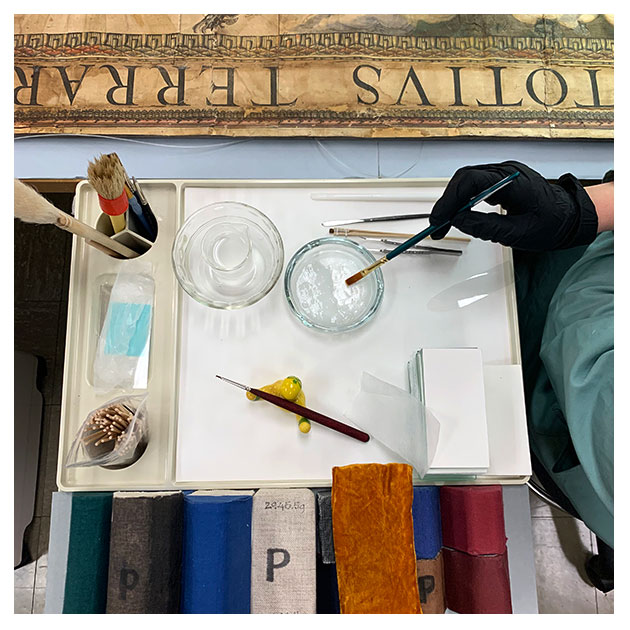
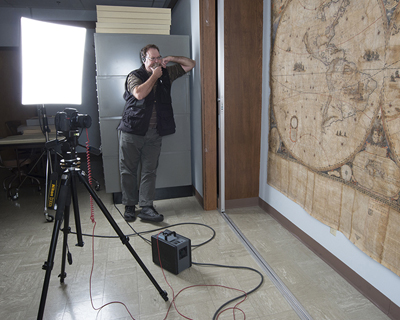
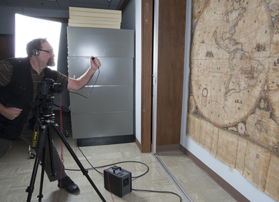
In recent blog posts, we examined the science behind the Blaeu World Map and took a deep dive into the conservation in progress to prepare the massive 371-year-old map for public display.  [Read more…] about How a famed astronomer paved the way for the Blaeu World Map

Filed Under: Conservation, Digital Collections, Featured1 Tagged With: Blaeu World Map, Blaeu-Map-19, conservation lab, great wall map, Joan Blaeu, Kraus map collection, maps, Willem Blaeu

The science behind the Blaeu World Map

December 11, 2019 - RANDI RAGSDALE

Explore the Harry Ransom Center, search digital collections, or plan your visit.

A one-of-a-kind 17th-century map housed at the Ransom Center for decades, currently too fragile to display, is now the subject of an intensive research and conservation project that will utilize scientific analysis to reveal the hidden story behind the map’s production and significance. [Read more…] about The science behind the Blaeu World Map

Filed Under: Conservation, Featured1, Research + Teaching Tagged With: Blaeu World Map, Blaeu-Map-19, great wall map, Joan Blaeu, Kraus map collection, maps

The Great Wall Map Revealed

April 30, 2013 - Richard Oram

Pete Smith photographs great wall map. Photo by Pete Smith.

Until recently, one of the largest objects in the Ransom Center collections has also been one of the least visible. Joan Blaeu’s Nova totius terrarum orbis tabula (1648) is part of the Kraus map collection. Blaeu (1596–1673) was a member of a celebrated family of Dutch cartographers and is best known for his 11-volume Great Atlas. The Ransom Center has a hand-colored set of this monumental work (but that is a matter for a future blog post.)

Blaeu’s great wall map (GWM) is one of the largest ever published, measuring 2995 x 2043 mm, nearly 10 x 7 feet from edge to edge. Another copy was incorporated into an enormous atlas, often cited as the largest atlas in the world, made for Charles II but still the map had to be cropped to fit. Presumably the atlas did not accompany the king on road trips.

For the past 40 years, the GWM has been tucked away in a large wall case on the Ransom Center’s top floor. When we began to think about displaying the map as a focal point for a 2005 exhibition, we discovered that the GWM was simply too large to make a trip downstairs without being damaged, leading me to wonder how it had ever reached its seventh floor location in the first place.

Understandably, only a handful of people other than staff have ever viewed the GWM. A few years ago, we made digital images of the map for a scholar, section by section. These images were then assembled to make a medium-resolution composite image, which was later used when our Kraus map website went live in the spring of 2012. Yet, it was impossible to read the text in Latin and French at the bottom of the GWM, a guide for the use of the map aimed at “geography lovers.” Nor was it possible to appreciate fully the wealth of graphic detail—for example, the fleets sailing in the Atlantic and Pacific Oceans—that is so characteristic of baroque map-making.

This past fall, Ransom Center photographer Pete Smith took up photographing the map as a personal challenge. He first needed our stacks maintenance unit to remove a range of shelving in order to get far enough away from the map so that he could shoot high-quality images. After two days of work, he had 120 high-resolution images, from which 30 were selected for use.

This was only the beginning. Anybody who has used Photoshop can appreciate how difficult it is to stitch together this many digital images by hand. Fortunately, specialized software was available to create a composite image of the huge map. Processing took a fast computer an hour. Although the final product is a behemoth file of 1.5 gigabytes, the web servers handle it with amazing efficiency.

We often say that viewing a digital surrogate is no substitute for interacting with the original, and it is undeniable that one cannot comprehend the sheer scale of the GWM by looking at it online. On the other hand, it is almost impossible to study the original map in any detail, even if one has access to the stacks. Digitization made essentially invisible object accessible to anyone with a computer.

Pete Smith photographs great wall map. Photo by Pete Smith.

Filed Under: Photography Tagged With: Blaeu World Map, geography, great wall map, Joan Blaeu, Kraus map collection, maps, Nova Totius Terrarum Orbis Tabula, Pete Smith, Photography

Next Page »

Primary Sidebar

Archive

Tags

acquisition Alice's Adventures in Wonderland archive archives Art Books Cataloging Conservation Council on Library and Information Resources David Foster Wallace David O. Selznick digitization exhibition Exhibitions Fellows Find Fellowships Film Frank Reaugh Frank Reaugh: Landscapes of Texas and the American West Gabriel Garcia Marquez Gabriel Garcia Marquez archive Gone with the Wind I have seen the Future: Norman Bel Geddes Designs America Lewis Carroll literature Magnum Photos Manuscripts Meet the Staff Nobel Prize Norman Bel Geddes Norman Mailer Performing Arts Photography poetry preservation Publishing Research Robert De Niro Shakespeare theater The King James Bible: Its History and Influence The Making of Gone With The Wind Undergraduate What is Research? World War I

Recent Posts

  • The Knickerbocker Theatre Collapse
  • On the Record: Black Creators and the Jazz Age
  • Ransom Center experience leads to new challenge for Monte Monreal
  • Films represented in the Drawing the Motion Picture exhibition
  • Celebrate with us in 2023

Before Footer

Sign up for eNews

Our monthly newsletter highlights news, exhibitions, and programs.

Connect With Us

  • Facebook
  • Instagram
  • Twitter
  • YouTube

About

Ransom Center Magazine is an online and print publication sharing stories and news about the Harry Ransom Center, its collections, and the creative community surrounding it.

Copyright © 2023 Harry Ransom Center

Web Accessibility · Web Privacy