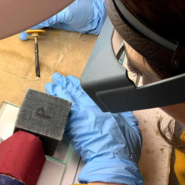
Kress Paper Conservation Fellow Emily Farek, working with paper conservators Ken Grant and Jane Boyd, describes the painstaking work of removing modern adhesive from the back of this very large (10′ x 7′) 1648 Dutch map titled, Nova totius terrarum orbis tabula, commonly known as the Blaeu World Map. [Read more…] about Conservators painstakingly remove glue that binds
Willem Blaeu
Seeing stars in the Blaeu World Map
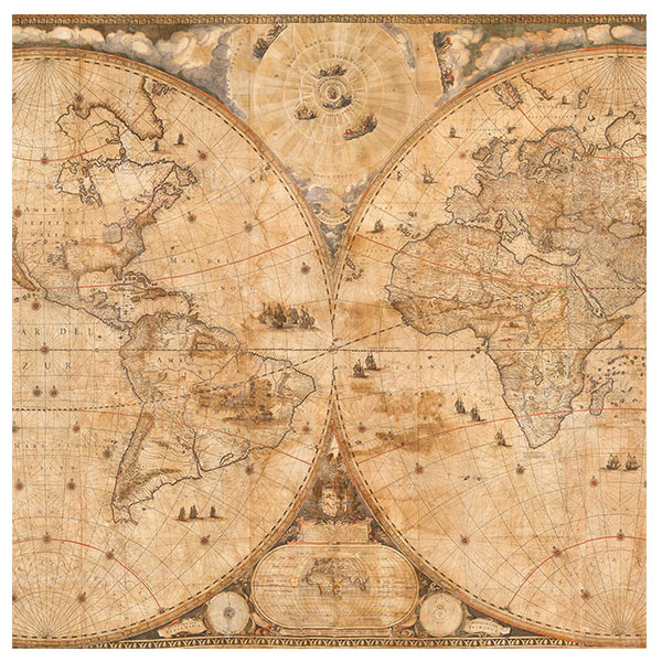
A fascinating project to preserve and display the iconic 1648 Dutch world map is now underway. In previous blog posts, we revealed the history of the Nova Totius Terrarum Orbis Tabula (Blaeu World Map) and the family of cartographers, globe makers, printers, and publishers who created it. We also have discussed the science and conservation taking place to prepare the Texas-sized 371-year-old map (learn more about the map) for public display. [Read more…] about Seeing stars in the Blaeu World Map
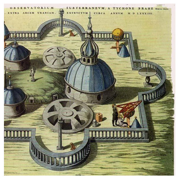
How a famed astronomer paved the way for the Blaeu World Map
A Q & A with Dr. Bruce Hunt about the Blaeu World Map
In recent blog posts, we examined the science behind the Blaeu World Map and took a deep dive into the conservation in progress to prepare the massive 371-year-old map for public display. [Read more…] about How a famed astronomer paved the way for the Blaeu World Map