BY CARLOS E. RAMOS-SCHARRÓN
Landscape is . . . a land shape, in which the process of shaping is by no means thought of as simply physical. —C. Sauer (The Morphology of Landscape, 1925)
For Karl
I am still relishing being a fashionable latecomer to the field of geography, particularly to historical geography. Many of its tenets seem, if not totally new, at least still “hip” to me. Like many before me, I wish to apply a variety of tools to consult archived information recorded by landscapes. This approach is not new to me. As a geomorphologist, I have learned to appreciate landforms—hillslopes, rivers, valleys, and so forth—as a product of both past and contemporary processes. However, this landscape that I write about here not only refers to the physical but also to human conceptions of space. This viewpoint calls for a transdisciplinary approach that challenges traditional scientific efforts. It also opens the door to self-reflective evaluation, as I recognize myself as a participant within the boundaries of my study area. Science, then, may be understood as having the potential to be both cause and effect: it generates its own impact but it also represents a social response to an awareness of the need for environmental conservation.
Throughout my career, my research has concentrated on physical phenomena. I study the effects of land-use conversion (for example, deforestation linked to urban expansion or agriculture) in the generation of surface runoff, sediments, and water-borne pollutants, and their consequential effects on coral reef ecosystems. The utility of my research is geared toward the protection of soil and water resources, as well as the conservation of coral reefs on islands of the Caribbean. Coral reefs are essential to the well-being of many islands, as they serve to buffer coastlines from the damaging effects of storm surges and tsunamis. They also serve as the source of the white sands for which the region’s beaches are widely known, and are essential for the economic and cultural livelihoods of many people as they directly support the fishing and tourism industries. However, Caribbean coral reefs have suffered notable degradation since at least the late 1970s and the causes are multiple and diverse. Coral reefs are not only susceptible to the type of water pollution resulting from land-based human activities that I study, but they may also be affected by the physical destruction of coral into rubble that occurs during hurricanes, the bleaching and high incidence of disease that follow warmer-than-normal seawater temperatures, and overfishing, as population collapses of keystone fish species responsible for grooming reef surfaces can affect coral reproduction.
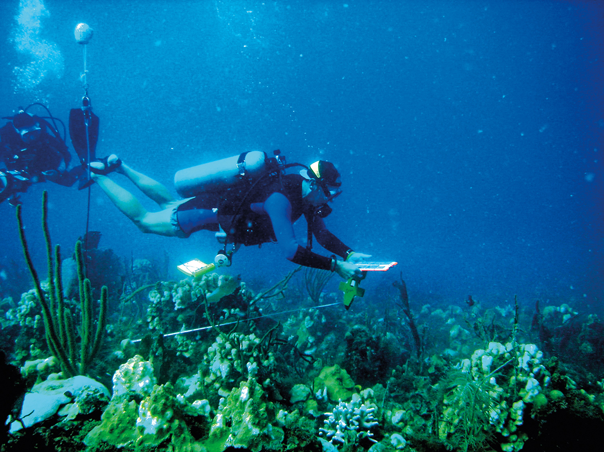
If the causes of coral reef degradation are potentially so varied, how do I reassure myself that my specific research efforts are worthwhile and that they might result in effective environmental conservation efforts? Here, I briefly trace the history of land use and scientific endeavors in one of my study areas in the U.S. Virgin Islands. My intention is to showcase a few of the advantages of following a transdisciplinary approach to scientific efforts—efforts that involve collaborations with historians, ethnographers, economists, marine ecologists, and others. For me personally, one of the benefits of this approach is being able to situate my work within the trajectory of a place and to position its relevance within a larger environmental conservation effort.
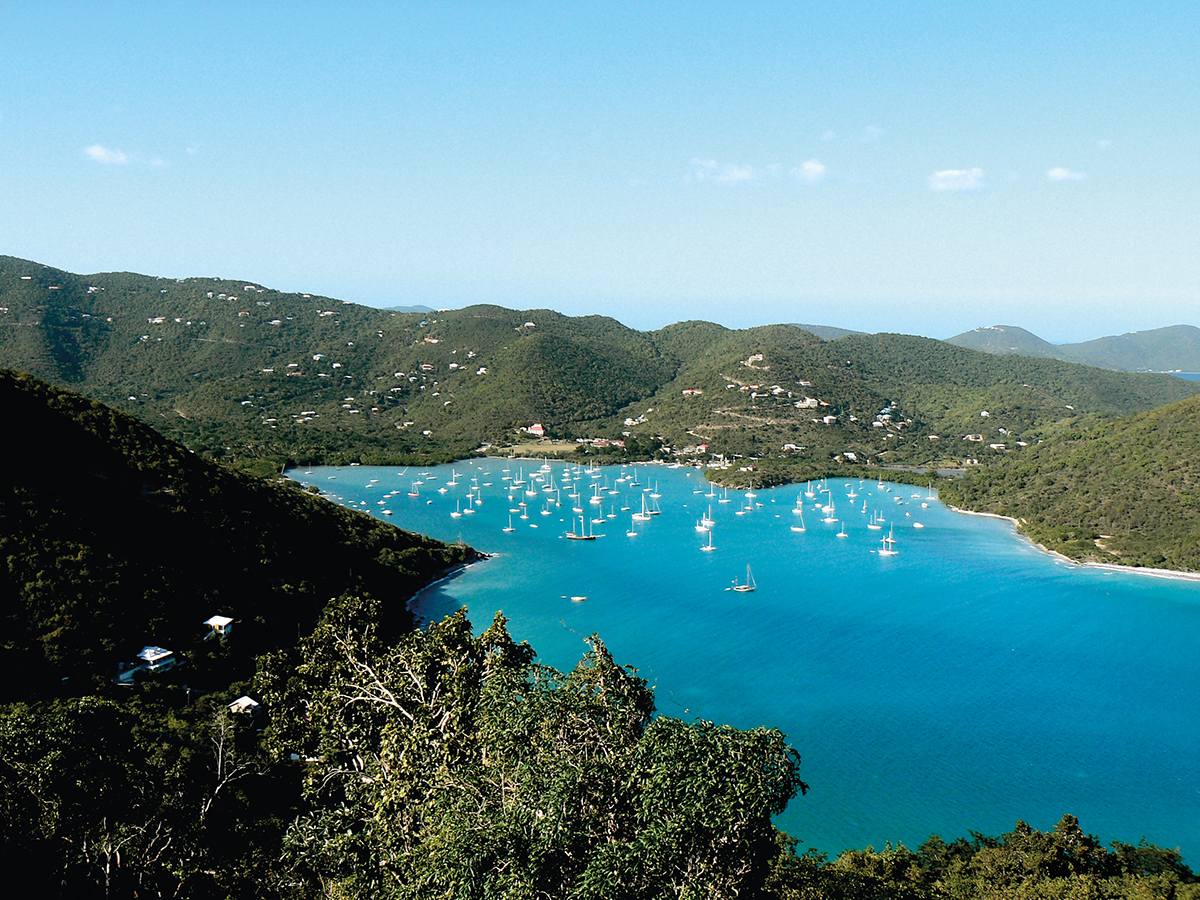
Like most other islands of the Caribbean, St. John, the smallest of the three main islands now composing the U.S. Virgin Islands Territory (USVI), has undergone severe changes since European colonization. With the exception of itinerant groups of Arawak indigenous populations, marauding bands of pirates, and occasional woodcutting squads, the island remained mostly uninhabited until the early eighteenth century. St. John became permanently colonized in 1718 by Denmark as it sought to expand its participation in the New World economic and political scene. In spite of the natural unsuitability of the island’s steep terrain, limited freshwater resources, and shallow soils for agricultural production, a predominantly sugar plantation–style economy dominated from the eighteenth until the mid-nineteenth century, and this meant the decimation of most of its forest cover. By 1800, cane fields covered almost one-third of the island’s landmass. At this time, only about half of the island was classified as woodland, although this was an already decimated forest that had served to supply wood for construction materials and fuel for cooking and sugar boilers.[1] The hard labor of cutting the forest, tending the cane fields, and processing the sugar was carried out by an African slave population that fluctuated from 730 to 2,160 in the years between 1739 and 1800. The few references to corals and other marine resources of this period are limited to the reliance on fish and other organisms as a source of protein, the production of lime from coral rubble, and the use of coral as building blocks for estate houses and sugar factories.
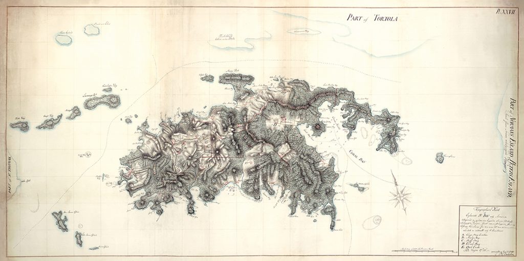
The inevitable collapse of the sugar economy occurred during the second half of the nineteenth century. The main reasons for its demise were poor productivity due to loss of soil fertility, a drop in sugar prices, and the inability of the sugar estates to maintain a labor force following the abolition of slavery by Denmark in 1848.[2] A peasant-based economy mostly devoted to cattle grazing, subsistence fishing/farming, and both charcoal and bay rum oil production followed, dominating the landscape for an entire century, even after the purchase of the Danish West Indies by the United States in 1917. The period saw a decline of human dominance over St. John, the result of a reduced human population and less demand for forest products and arable land. This restrained demand allowed for the growth of a secondary forest on the island. This continued up until the mid-twentieth century, as the importance of the USVI to the U.S. was mostly associated with its strategic military position. Disinterest was particularly accentuated in St. John, as described by a U.S.-based travel writer named Henry A. Phillips during a visit to the island in the mid-1930s: “In the main, the jungle has reclaimed its own. There are only a few rough trails on island fit for horseback riding. . . . Nearly twenty years of American occupation, and no roads!”[3]
At this time the island still failed to show obvious signs of becoming the tourist attraction it is today, but its potential was already being recognized. In the words of Dr. Arthur I. Edison, St. John’s administrator at the time: “I wish to inform you that there is nothing available at the present time for the accommodation of tourists as there are two young men at the Moorehead Boarding house. . . . The numerous requests I have been receiving would indicate a real interest in vacationing in St. John.”[4]
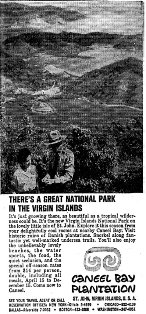
Following the Second World War, local authorities and U.S. investors began speculating on St. John’s potential for high-end real-estate development and as a tourist destination. One of those men was Laurance S. Rockefeller, who, embracing his father’s model in Acadia and Grand Teton National Parks, allegedly envisioned that a combined luxury tourist experience with a well-preserved natural landscape would be of benefit to St. John and St. Johnians.[5] Mr. Rockefeller was key in the establishment of the Virgin Islands National Park (VINP) on St. John in 1956 as the backdrop to his newly acquired hotel, Caneel Bay. The designation as a park allowed this land to “be administered and preserved . . . in its natural condition for the public benefit and inspiration, in accordance with the laws governing the administration of the national parks” (84 U.S.C. § 925). VINP came to occupy about two-thirds of the island’s landmass, while the remaining third was left for private ownership.
Little formal knowledge of the island’s marine resources existed until 1958, when the first inventory of the submerged lands surrounding St. John was conducted. Realization of the magnificence of those resources eventually led to the revision of the park boundaries in 1962 in an attempt to “preserve for the benefit of the public significant coral gardens, marine life, and seascapes” (87 U.S.C. § 750). At this stage, the marine, terrestrial, and human landscape became subjugated to a combination of “foreign” conservation regulations largely imposed by the National Park Service with land development interests. For the most part, both of these excluded the participation of the local population. The accelerated development that ensued as a result of the postwar real-estate boom unequivocally led to “economic benefits derived from growth and development which include the highest per capita income in the Caribbean,” but also to “the degradation of ecosystems, the depletion of natural resources, the ills of urbanization.”[6]
One of the downsides of St. John’s inclusion on the “world map” during the postwar years involved the unprecedented disruption of the physical landscape. Even though most of the soils of the island had been disrupted during the plantation era, the 1950s represent the first time these were disturbed by the products of the Industrial Revolution. Oil-fueled heavy machinery began establishing the style of human footprint that has typified land use during the twentieth century through road construction and excavation of home and commercial sites. The enhanced soil erosion that ensued provoked an abrupt change in the sedimentary records of some of St. John’s bays, where an acute tenfold increase in the levels of sediment deposition was registered.[7] This new landscape alteration method therefore severely enhanced the level of human-related stress on St. John’s coral reef ecosystems and is still considered a main cause of environmental degradation on the island.[8]
While the timing of the park’s establishment coincides with accelerated environmental degradation, it is unequivocal that it also led to some positive environmentally oriented outcomes. Obviously, much land was declared off limits for development, and this promoted further reforestation. In addition, strict fishing and boating restrictions have led to the protection of fish populations and other marine resources. A less obvious positive outcome is that the fame associated with the establishment of the park also led to the creation of a unique knowledge base. Human conceptualization of a park is accompanied by the idea that the area merits study. In addition to tourists, developers, and others seeking a new lifestyle, VINP also attracted research and funding for it. As a consequence, many have described the island from their varied perspectives, and this includes historical documentation through archival and archaeological research, empirically derived anthropological insights into issues of resource governance and race relations, ecological monitoring of both marine and terrestrial settings, and geological descriptions based on sediment cores, field experiments, and hydrological modeling. Formal documentation of the St. Johnian environment has a long tradition relative to most other islands, and this was initially facilitated after the VINP was named a Biosphere Reserve by UNESCO’s Man and the Biosphere Program in 1976. Execution of the mandate associated with this declaration required assessing environmental baselines of terrestrial, marine, and human systems to be used as baselines for continued efforts to monitor and document environmental change.[9] These monitoring efforts continue through a combination of both government- and academia-led efforts including the South Florida/Caribbean Inventory and Monitoring Network of the National Park Service and the USVI Territorial Coral Reef Monitoring Program.
The research that has been conducted on St. John is unmatched throughout the Caribbean, and I dare say it is exceptional relative to most other small island settings worldwide. The knowledge generated by the multiple research efforts executed on St. John shapes coral reef management both locally and elsewhere. In part due to the locally conducted research, St. John is home to successful science-fueled community-based coral reef conservation efforts meant to mitigate the effects of land development on sediment delivery to coral-bearing waters. Examples are those executed by the Fish Bay Homeowners Association and the Coral Bay Community Council in collaboration with federal agencies such as the National Oceanographic and Atmospheric Administration and the Environmental Protection Agency, in which science has guided the selection of watershed mitigation methods while also helping to evaluate their effectiveness. Some of the science generated on St. John has also served watershed management efforts in the nearby islands of Vieques and Culebra in Puerto Rico.
Has the combination of conservation and research efforts prevented the degradation of coral reef ecosystems surrounding St. John? Unfortunately, the answer to this question is “no,” as protected coral reefs appear to have suffered a similar degree of degradation as those in unprotected areas.[10] Additional work is thus essential. One still-unexplored option is to evaluate the breadth of knowledge established for St. John through a transdisciplinary lens to advance a new breed of conservation solutions. This approach could not only aid in narrowing down the specific factors leading to coral reef degradation on St. John, but also could serve in developing new landscape governance ideas that not only address the physical landscape through the use of sound scientific knowledge but also attend to human perceptions and help evolve our understanding of natural resource conservation.
Carlos E. Ramos-Scharrón is assistant professor at the Teresa Lozano Long Institute of Latin American Studies (LLILAS) and the Department of Geography and the Environment at The University of Texas at Austin.
Notes
[1] G. Tyson, “Historic land use in the Reef Bay, Fish Bay and Hawksnest Bay Watersheds, St. John, U.S. Virgin Islands, 1718–1950,” Biosphere Reserve Research Report no. 19 (1987).
[2] K.F. Olwig, Cultural Adaptation and Resistance on St. John: Three Centuries of Afro-Caribbean Life (Gainesville: University Presses of Florida, 1985).
[3] H.A. Phillips, White Elephants in the Caribbean: A Magic Journey Through All the West Indies (RM McBride & Co., 1936,) 193.
[4] R.H. Low and R. Valls, St. John Backtime: Eyewitness Accounts from 1718 to 1956 (Newtown, CT: Eden Hill Press, 1985).
[5] C.L. Fortwangler, “Producing and Preserving Park Island: Transforming St. John, U.S. Virgin Islands into a Leisure-oriented Space,” PhD dissertation, University of Michigan, 2007.
[6] B. Gilliard-Payne, “The dynamics of striking the balance among conservation, recreation, and business development needs in the U.S. Virgin Islands,” in Conference Proceedings of the Society of Virgin Islands Historians, 1988–1992, 1992, 23–50.
[7] G. Brooks et al., “Sedimentary development of Coral Bay, St. John, USVI: A shift from natural to anthropogenic influences,” Caribbean Journal of Science 43(2) 2007: 226–243.
[8] C.E. Ramos-Scharrón and L.H. MacDonald, “Measurement and prediction of natural and anthropogenic sediment sources, St. John, U.S. Virgin Islands,” Catena 71 (2007): 250–266.
[9] E. Towle and C. Rogers, “Models, metaphors, networks, and insular biosphere reserves: The Virgin Islands Case,” contribution to the UNESCO/IUCN Workshop on the Application of the Biosphere Reserve Concept to Coastal Marine Areas, San Francisco, CA, August 14–20, 1989.
[10] S.J. Pittman et al., “Marine protected areas of the U.S. Virgin Islands: Ecological performance report,” NOAA Technical Memorandum NOS NCCOS 187 (Silver Spring, MD, 2014).


