We use Interferometric Synthetic Aperture Radar (InSAR) techniques to measure up to millimeter-sized changes on Earth from imaging radar satellites orbiting 800 km or more above. Our strength is the development of new algorithms using advanced signal processing and high-performance computing to process large volumes of InSAR data corrupted by noise. We investigate how these radar measurements can be related to properties of the earth surface and subsurface for geoscience studies including but not limited to earthquakes, volcanoes, groundwater aquifers, hurricanes, and permafrost. Our research is broad in scope. Students who are interested in these research areas are encouraged to apply through the department of Aerospace Engineering and Engineering Mechanics at the University of Texas at Austin.
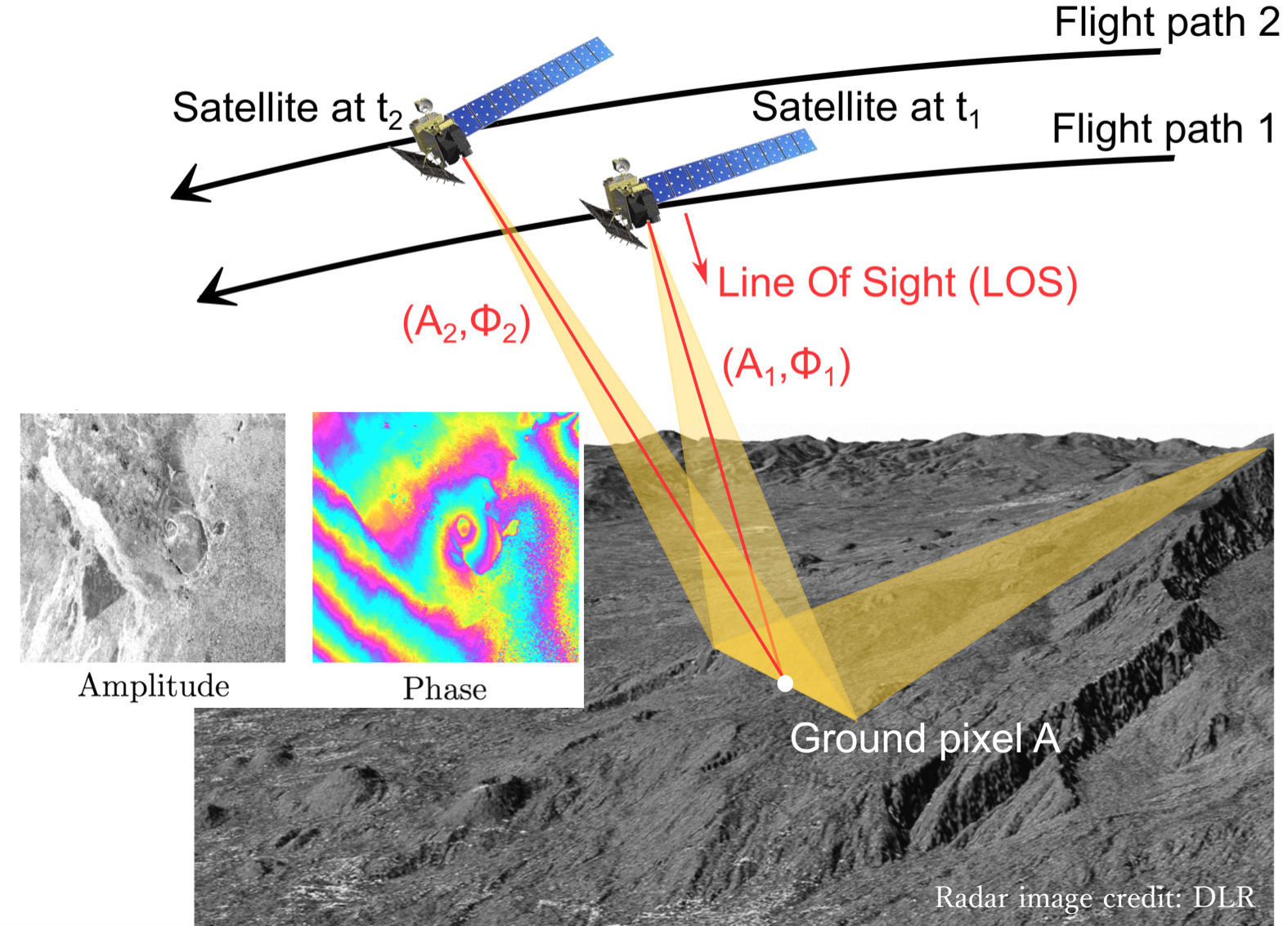
Fig.1 InSAR imaging geometry. The phase difference between two satellite passes over the same region can be used to measure small surface deformation with up to meter-level spatial resolution and almost global coverage.