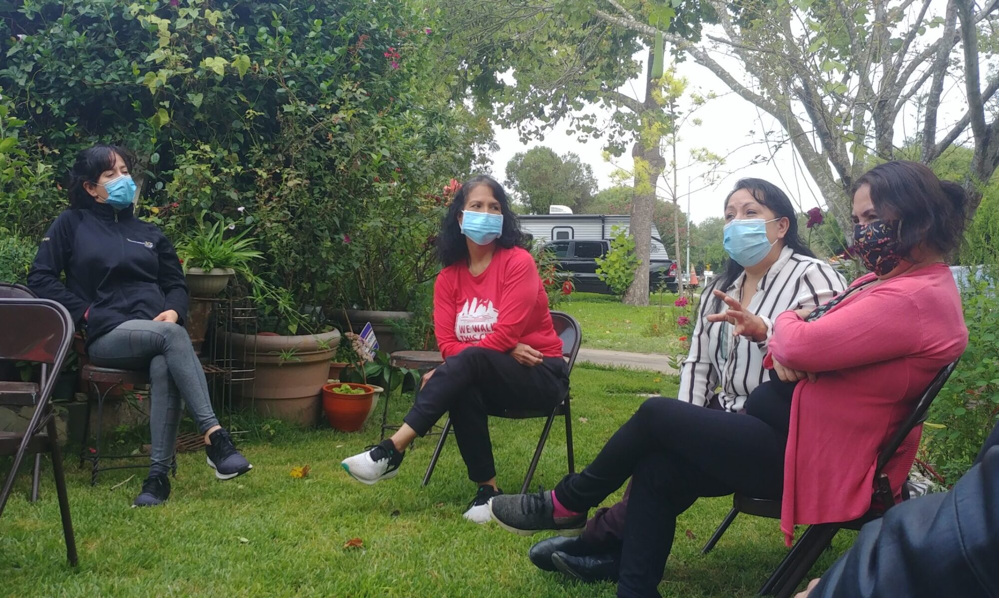
Our research showed that residents have nuanced and diverse perspectives on the park. While they want to maintain the natural aspects of the park, they also want it to be safe and convenient for community members to enjoy. This calls for design solutions targeted to specific sites within the park in order to facilitate a multitude of uses.
The final report with detailed recommendations is available here.
Story Map
A story map is an interactive tool that uses texts, pictures, videos and maps to convey information. Since our project involved youth participation, we developed a story map in order to bolster their engagement as the project continues. The story map also allowed us to show the multiple meanings that residents attach to the park and the iterative design process we used. See the story map HERE.
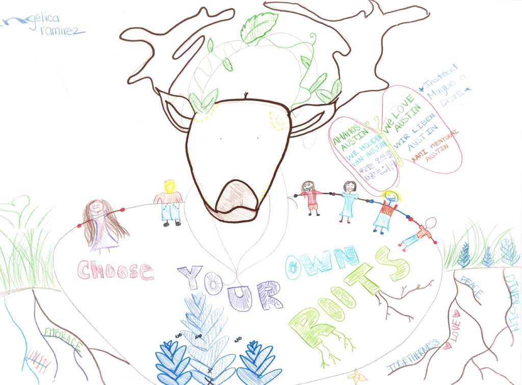
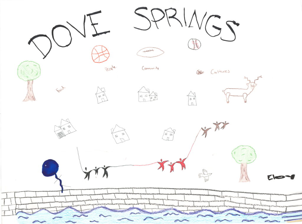
Mural
Residents decided that the park design should include a mural in order to convey community history and values. The mural design process involved the youth drawing their ideas as well as discussions between the youth, the muralists, and residents. Going forward, the community art activists Monica Maldonado and Filiberto Mendieta will facilitate the continuing work on the mural, including further community conversations, final designs, and the participatory painting process. Mr. Mendieta created the Selena mural on 1619 East Cesar Chavez Street.
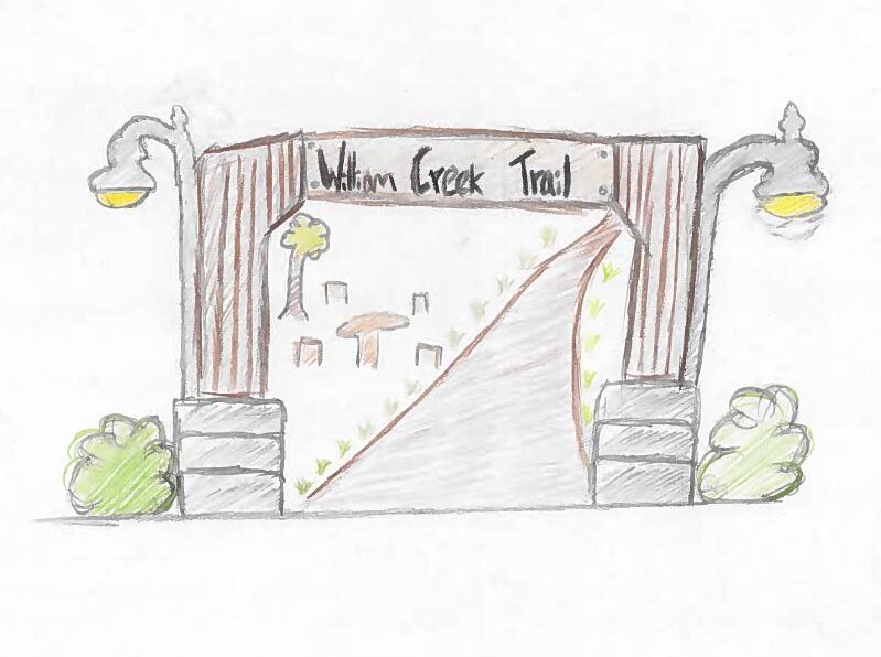
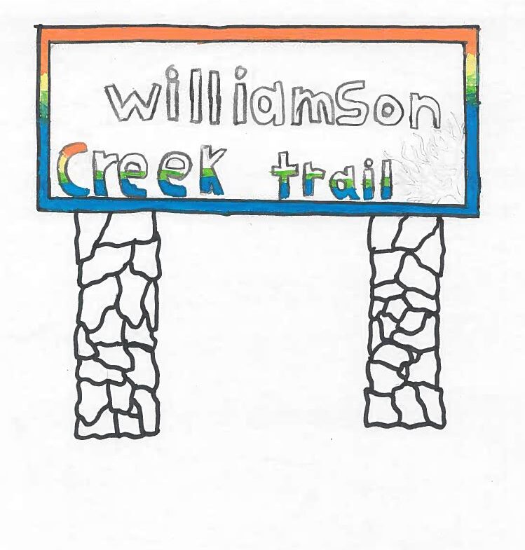
Entrance
The entrance design process involved the youth and residents conceptualizing welcome signs for the park. In a community workshop, residents discussed and selected the elements that should go into the entrance design. The next steps include evaluating the feasibility and permitting restrictions of the entrance sign that is ultimately selected.
Interpretive Signs
Community members suggested erecting interpretive signs throughout the park in their interviews and pit-stop walks. We carried this idea forward with a preference survey held during a community-based workshop to finalize themes for the signs. Residents preferred interpretive signs about memories (such as the history of Dove Springs and how the community evolved), culturally significant elements (such as information about Mexican native plants that community members grow in their gardens), and youth education (such as information about park maintenance and wildlife preservation).
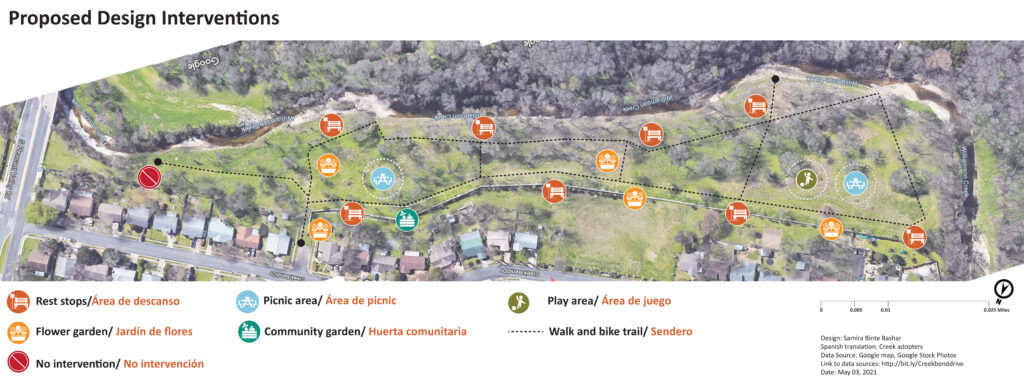
Physical Designs
In proposing possible design solutions, we balanced the community’s desire to keep the site natural yet maintained enough for human activity. The following design options were developed considering the site’s regulatory and natural constraints. As such, we provided the community with ‘Basic’ and ‘Advanced’ design options for spaces within the site that presented limitations we needed to work around. As third-party supporting participants, our goal was not to choose a final design, but to aid the community in discussing and imagining a new identity for the site through design options.
Entrance
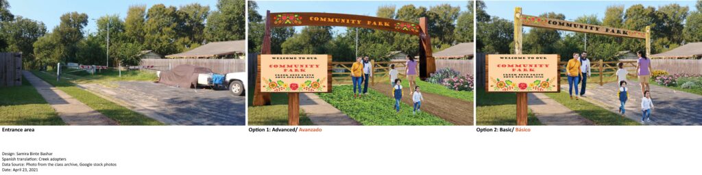
Residents want to see a welcoming, recognizable entrance to the trail. In the first workshop in the spring, residents voted on their favorite drawing of the entrance sign and gates sketched by Urban Roots youth, and elements of the winning drawings are incorporated in this design. Both options include an entrance sign, two waist-high gate doors to prevent vehicular traffic and a large arching sign held by two pillars. The ‘Advanced’ option has a more prominent gate with heavier and higher quality wood and include planters to discourage parking. The concrete pavement has been removed and replaced with grass and decomposed granite to indicate the start of the trailhead. The ‘Basic’ option has a less prominent gate structure and uses roughly cut lumber. The concrete pavement has been kept intact.
Short Floodwall
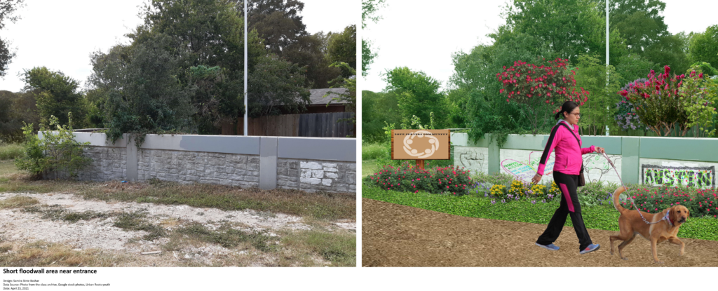
This figure shows the entrance area immediately inside the gate at the beginning of the floodwall. Residents expressed interest in having murals painted on the wall, including here in the entrance, as a way to represent community identity. An interpretive sign will further describe the character of the community. (The mural and sign designs are for illustrative purposes only. Please refer to the mural and interpretive sign themes above.) This part of the entrance area will also be beautified with wildflowers and include a trail surfaced by decomposed granite or grass cover bordered with mulch along the edges.
Floodwall
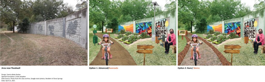
This is a small, cozy space near the flood wall where the brush has already been cleared. Residents want to see a rest stop and community garden space installed here with interpretive signs and a mural design on the floodwall. (The mural design and interpretive signs are for illustrative purposes only. Please refer to mural and interpretive sign themes above.) The ‘Advanced’ option includes a trash receptacle with doggy bags for dog owners, a solar-powered light, a water fountain, and a decomposed granite trail. The ‘Basic’ option only includes a trash bin and a grass-covered trail bordered with mulch to prevent grass and weeds from entering.
Open Area
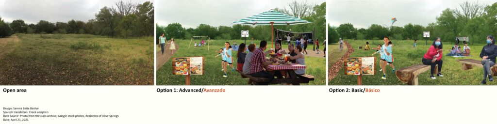
This the largest open space in the site providing opportunity for group activities. Residents want to see low-impact sporting activities, such as soccer or volleyball, and many also want to include picnic tables and benches. The ‘Advanced’ option includes picnic tables, playground equipment, a volleyball and basketball court with a base of decomposed granite, and a decomposed granite trail. The ‘Basic’ option includes structures of natural materials that can wash away in floods without causing damage, including a volleyball net tied between trees, a basketball hoop without the court pavement, log benches, and space for picnic blankets and soccer. These options both illustrate the desire of older residents to maintain the grasses short along trails and rest areas.
Creek Edge
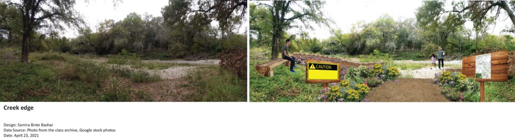
When the creek is dry, a low-water crossing provides informal and temporary access to additional trails in the Williamson Creek Greenbelt. A trail leading to the crossing will be clearly delineated and beautified with wildflowers, and a low wall constructed from logs will steer hikers away from the higher edge of the creek. Visitors will see two signs: one a cautionary sign about risks of crossing when the creek is full and another explaining the history of the creek and providing a map of the trail network in the Williamson Creek Greenbelt. This figure also illustrates the desire of older residents to keep the grass short along the edge of hiking trails.