Categories
Global Policy Studies & International Security Multimedia Politics and Governance Technology Policy

In Defense of Pretty Maps

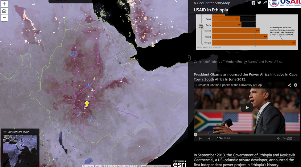
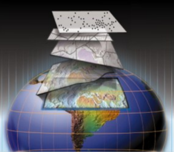
Cartography is pretty hot these days. Maps tap into our brains’ spatial reasoning abilities to make any public issue more immediate and understandable to wider audiences—and with the advent of open data and free tools, anyone with a computer can produce maps. Clearly, the trend has particular consequences for policymaking, although the burden of proof […]

Making Maps for Data Driven Decisions

During my internship with the Center for Accelerating Innovation and Impact (CII) in the Global Health Bureau at USAID, I attended a training that the GeoCenter conducted. They are a team of geospatial analysts who work to integrate a geographic approach into USAID’s development programs. Participants learned how to make and use maps to answer […]

Social Widgets powered by AB-WebLog.com.