Oceania is known for its low-lying island nations, with over 10,000 islands, represented by over 20 countries (including territories/dependencies), spanning an area approximately the size of the United States. Monitoring threats such as sea level rise, tropical storm paths, and water quality is impossible for these nations to do using traditional in situ data sources based on the limited resources they possess.
Remote sensing and the use of satellite and high-altitude data, when integrated with climate modeling and emergency management, gives us the ability to more effectively plan and combat these threats. Advancements in technology is shifting the application from traditional land change monitoring tools to more advanced health, enforcement, and prediction tools that can be used to identify specific at-risk populations at higher resolutions over larger areas.
Satellite remote sensing and the use of Earth observation satellites is beneficial because the data provided has the 4V features necessary for climate research.
- Velocity: Data is continually being processed and updated. Data is often available within days or weeks of being captured.
- Volume: The amount of data available is substantial. According to the Union of Concerned Scientists, as of March, 2019, 37% of all operation satellites have Earth observation functions.
- Variety: From air/water temperature, particulate matter, and soil type to panchromatic, infrared, and night-time imagery, publicly available data is incredibly diverse.
- Veracity: Earth observation data is reliable and accurate, being constantly monitored and calibrated by engineers across the globe.
Traditional Applications of Remote Sensing
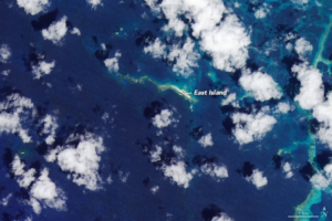
Satellite remote sensing has traditionally been used to track changes over time, specifically in relation to land use and area change. Land use (or land cover) change is particularly useful in quantifying urbanization, deforestation, agricultural productivity. This is particularly useful for Oceania as these countries have limited land resources. In conjunction, tracking total land area over time and changes in shoreline profile is made possible through the use of satellite imagery going back decades. Furthermore, traditional uses of satellite data to track short term weather and long term climate changes provides scientists and stakeholders with an arsenal of knowledge to better predict and ideally prepare for extreme events.
Advancements in the Application of Remote Sensing
Artificial intelligence, higher resolution imagery, and new sensors are just some of the new features of remote sensing that is revolutionizing what is able to be studied through satellite earth observations. Specifically, three new applications are of particular use to Oceania:
- Combating illegal fishing: In a 2017 article former supreme allied commander of NATO James Stavridis emphasized the threat of illegal fishing. As one of the main food source and economic industry for numerous communities in Oceania, illegal fishing threatens their livelihoods. It is impossible to monitor illegal fishing activities in each country’s economic exclusive zones (an area the size of the US) with only patrols and observation posts. Advancements in artificial intelligence image classification, numerous non-governmental agencies and commercial businesses are able to identify and track illegal fishing vessels. Being able to directly target their locations, law enforcement agencies are better equipped at curbing this threat.
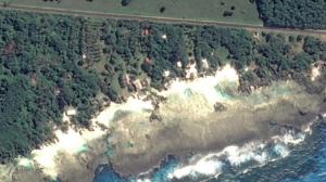
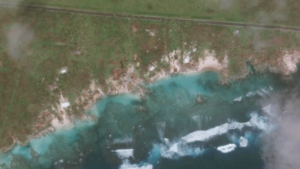
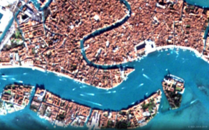
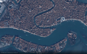
- Higher resolution images: The shuttle resource topography mission (SRTM) provided the first complete elevation model of the entire world with a spatial resolution of 30 meters. Landsat imagery, which has been around since 1972, boasts the same resolution. Commercial companies, such as Planet or Digital Globe, now produce images with a spatial resolution of 72 cm and 30 cm, respectively. Higher resolution images are critical for island nations in order to conduct meaningful analysis at a scale appropriate for their land size.
- Supplementing renewable energy sector: According to the Global Energy Network Institute, Pacific Island Nations depend on fossil fuel imports for 80% of their energy consumption. Becoming energy independent will reduce the need to rely on foreign aid. Remote sensing atmospheric, oceanic, and other natural processes can allow for countries to develop renewable energy infrastructure and better identify site locations. The United Kingdom based Institute for Environmental Analytics is doing just that by partnering with small island nation states to explore appropriate renewable energy mixes (wind, tidal, and solar either land or ocean based) taking into consideration a country’s environmental, political, and economic situation.
Limitations and the future of remote sensing in Oceania
With any new technology comes limitations. The nature of countries in Oceania being small islands requires that remotely sensed data have a high spatial resolution. While this is possible with today’s technology, getting access to commercial data can be expensive. Therefore, leveraging strategic partnerships is necessary. The United Nations program CommonSensing through the UNOSAT office is just one example of how international agencies are aiding Oceania.
Remotely sensed data cannot replace localized efforts. When satellite imagery is integrated with local knowledge, dynamic monitoring tools can be constructed. For example, marine habitat mapping is made possible through collaboration of local communities, remote sensing engineers, and policy makers on a scale that would be impossible for any one group to accomplish. Furthermore, there are important metrics that can’t be seen with satellites. Qualitative data such as access to health services, poverty levels, or affordable housing options cannot be measured from space. New tools are looking into metrics to estimate such parameters with satellite imagery, but the quality of such data is often questioned.
Moving forward, stakeholders can continue to leverage remote sensing to quantify and visualize the nations that they represent. Vulnerability mapping that incorporates remotely sensed data will continue to be a critical aspect of climate planning. However, mapping alone will not be enough to combat the future negative effects. Interpreting the data into meaningful actions will require the combined efforts of policy makers, local communities and scientists.

