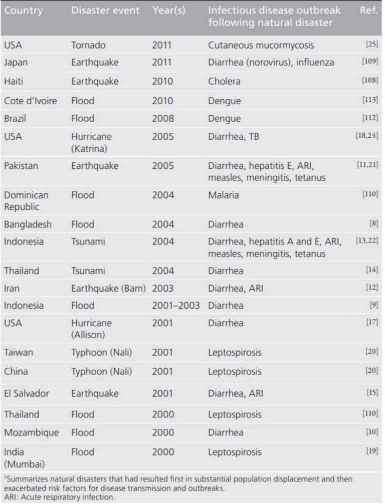
In many climate disaster related conversations, there is a villain that often flies under the radar. Communicable diseases are not at the forefront of climate change discussions. Island shores disappearing, dwindling water supplies, intense storms, air quality, and pollution all occupy disproportionately loud voices in the climate change conversation. Even… read more
I’m the Map, I’m the Map, I’m the Map, but What am I Saying?
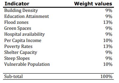
As the group crosses into serious data collection and needs visual tools to help express important data trends across geography, it is good time to list the challenges of hot spot mapping as it relates to Oceania. It’s important to remember, hot spot maps are supporting graphics, illustrating geographic trends… read more
Electrification in Oceania: Case Study of the Solomon Islands
The Solomon Islands is largest island nation in Oceania in terms of land area, and the second largest nation by population (excluding Australia, New Zealand, and Papua New Guinea). It also is the least electrified. Less than 20% of the population of Solomon Islands has access to electricity. Those who… read more
Island Geological Profiles and Associated Risks
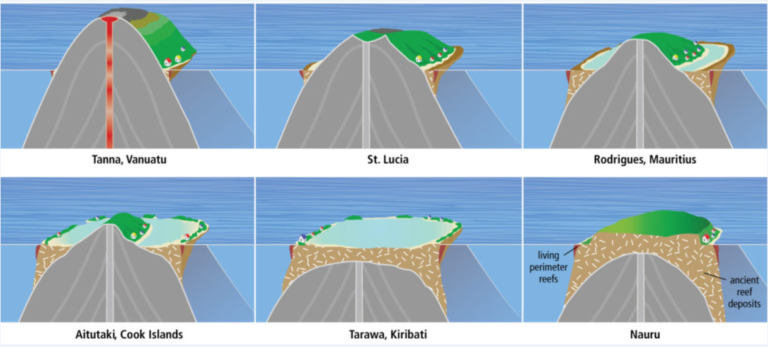
While there may be demographic, development, and economic factors that present disaster risks to Oceania states, the primary sources of disaster risk, particularly those resulting from climate change, stem from the geological foundations that make up tiny land masses these states call home. Island formations in Oceania can broadly be… read more


