LLILAS Initiative on Participatory Mapping and the Struggle for Land and Resources
Faculty Coordinator: Dr. Bjørn Sletto, Professor, Community and Regional Planning, School of Architecture
Community-based, participatory mapping has become an important tool for indigenous, Afro-descendant and other marginalized people in their struggles to secure their land and resource rights. However, participatory mapping need to be reconceptualized in light of emerging threats stemming from industrial agriculture, extractivism, climate change, and other pressures on land and resource rights. Indigenous people and community leaders are now forging new approaches to radical, participatory mapping for local development, resource management, and cultural conservation. This LLILAS initiative seeks to further conversation and research about these issues and to develop innovative strategies for participatory mapping practice. Participants include scholars, practitioners and indigenous and community leaders across the United States and Central and South America.
See the edited volume about participatory indigenous cartographies with contributions from initiative participants, forthcoming in September 2020 from UT Press.
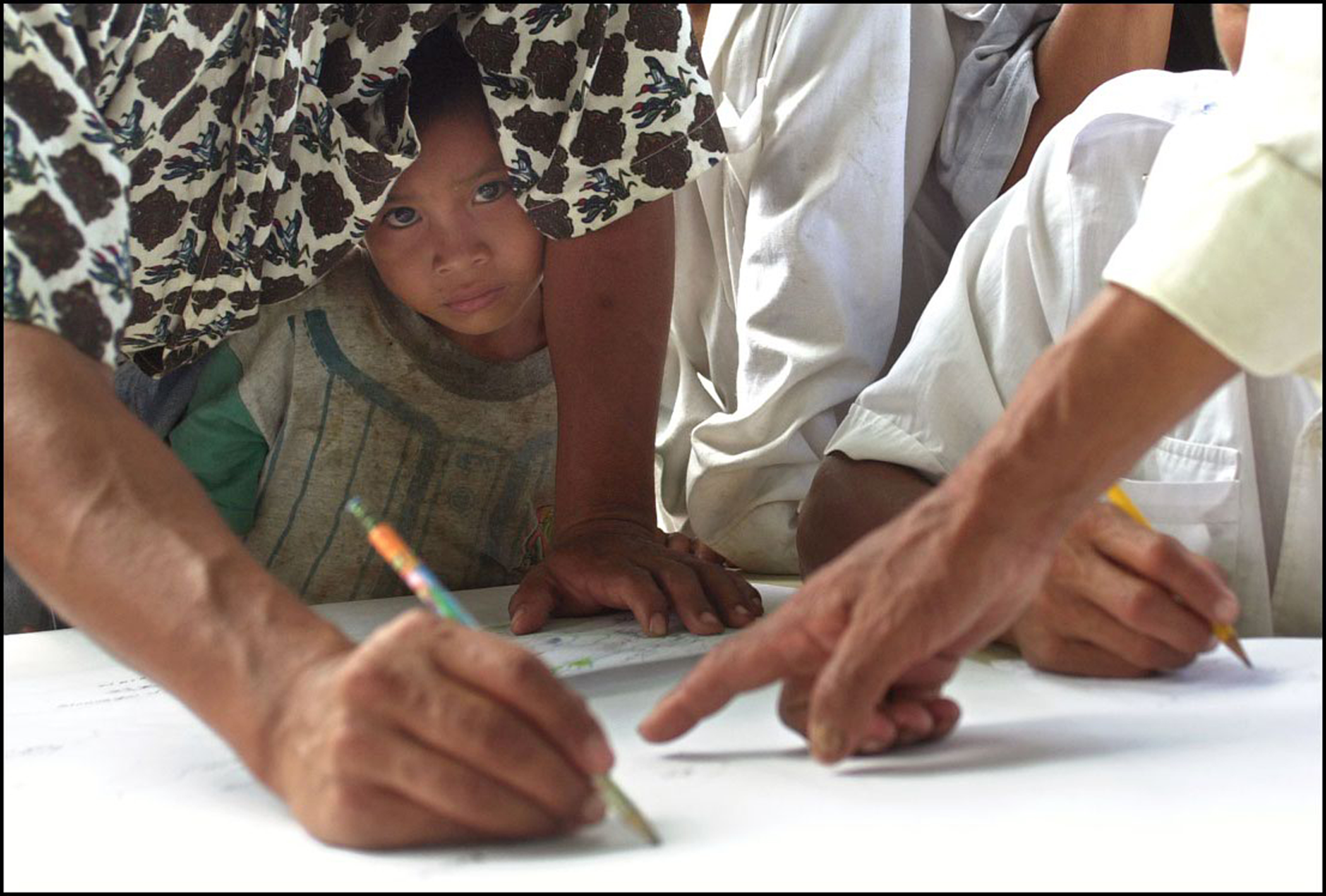
Participatory mapping in Vista Alegre, Pemon territory, Gran Sabana, Venezuela.
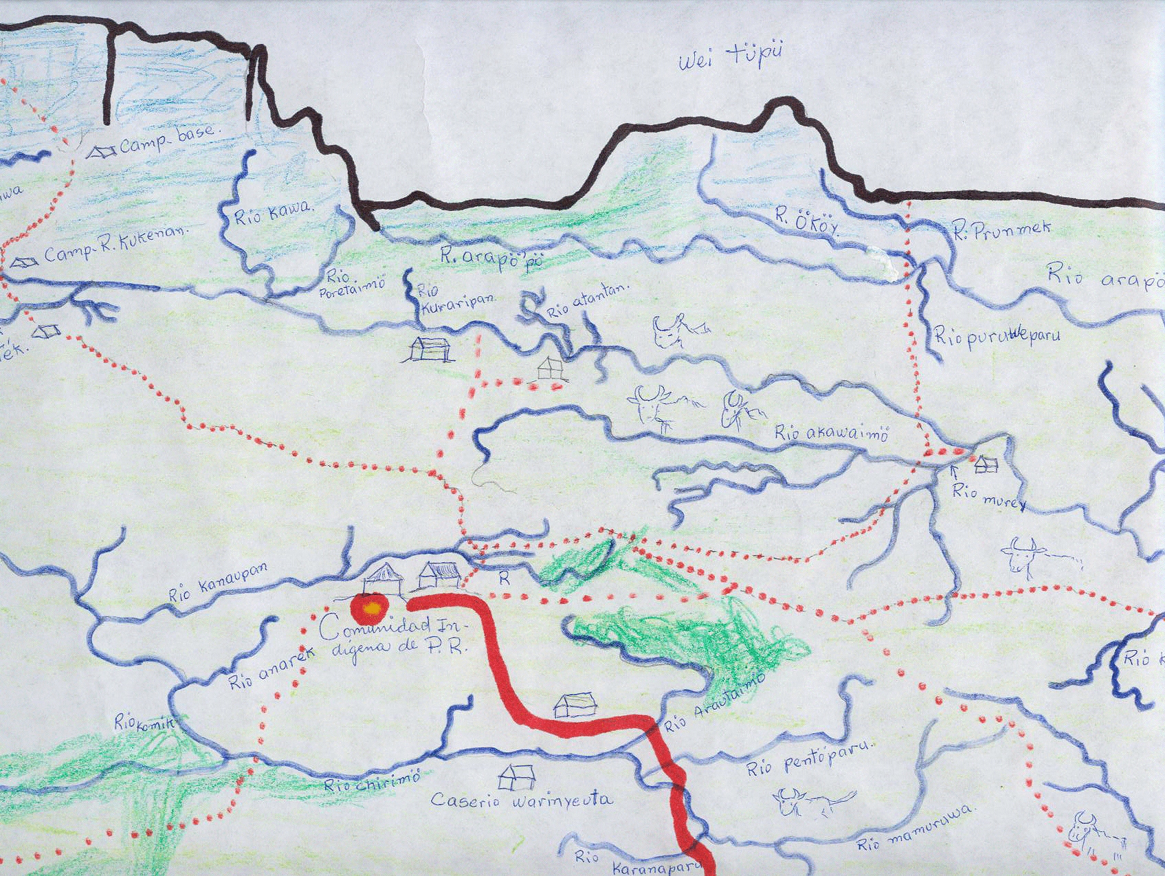
Elders’ mental map, Peraitepuy, Pemon territory, Gran Sabana, Venezuela.
Site development by Issa Ramos