Helena Andrade is concerned with the associations between resource management and indigenous collective identity, and the role of social cartography in terms of endogenous environmental conservation. She presented at The University of Texas in 2010 and was co-organizer of the LLILAS-sponsored, international conference on participatory mapping in Bogota, Colombia, in 2011.
Alfredo Vitery, Ecuador, and Wendy Pineda, Perú, are both critical observers of the role of participatory mapping in community-based work to document threats to indigenous resources and to develop endogenous strategies for territorial protection and resource conservation. They presented on their work in Ecuador and Perú at the LLILAS-sponsored, international conference on participatory mapping in Bogota, Colombia, in 2011.

Participatory ecosystem mapping in Kichwa communities, Ecuador. Photo courtesy Alfredo Vitery.

Participatory environmental monitoring team, FECONACO, Ro Corrientes, Perú. Photo courtesy Wendy Pineda.
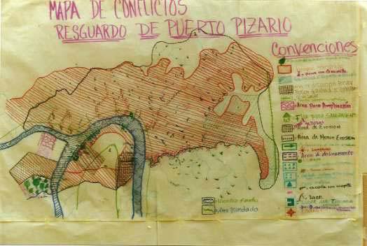
Environmental conflict mapping, Valle del Cauca, Colombia. Photo courtesy Helena Andrade.