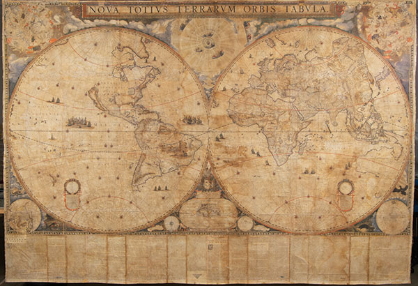
In an earlier blog post, we shared the science behind the Blaeu World Map. This week, Kress Paper Conservation Fellow Emily Farek dives into the treatment taking place to help extend the life of this unique 371-year-old wall map created by Dutch cartographer Joan Blaeu in 1648.
Over time, this incredible 17th-century map has gone through many changes that have altered its appearance. These alterations reflect its use, ownership, history, and the passing of time. A conservator’s job is to respect all of these changes, and ensure that the map will survive for 371 more years, while honoring the intention of the original artists and makers who created the map.
As the Kress Paper Conservation Fellow at the Harry Ransom Center this year, my job is to research and treat this great wall map. I formulated a conservation treatment plan after consulting with T.K. McClintock, a conservator with Studio TKM, Ltd., a private conservation practice that specializes in the treatment of large-scale works on paper.
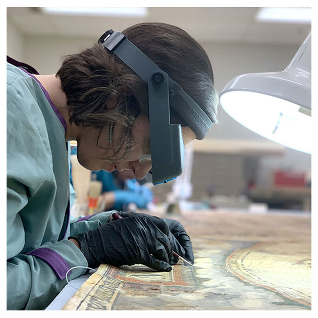
Treatment began in October 2019, and the first step was to stabilize the structure of the map so that it could be safely moved and handled for subsequent phases of treatment. At some point, the map had been folded and had gotten wet, resulting in creases, splitting, and tears in the paper, as well as tideline stains from the water. Paper Conservator Jane Boyd and I painstakingly consolidated and reattached each area of fragmented paper on the 70-square-foot map using wheat starch paste and small brushes.
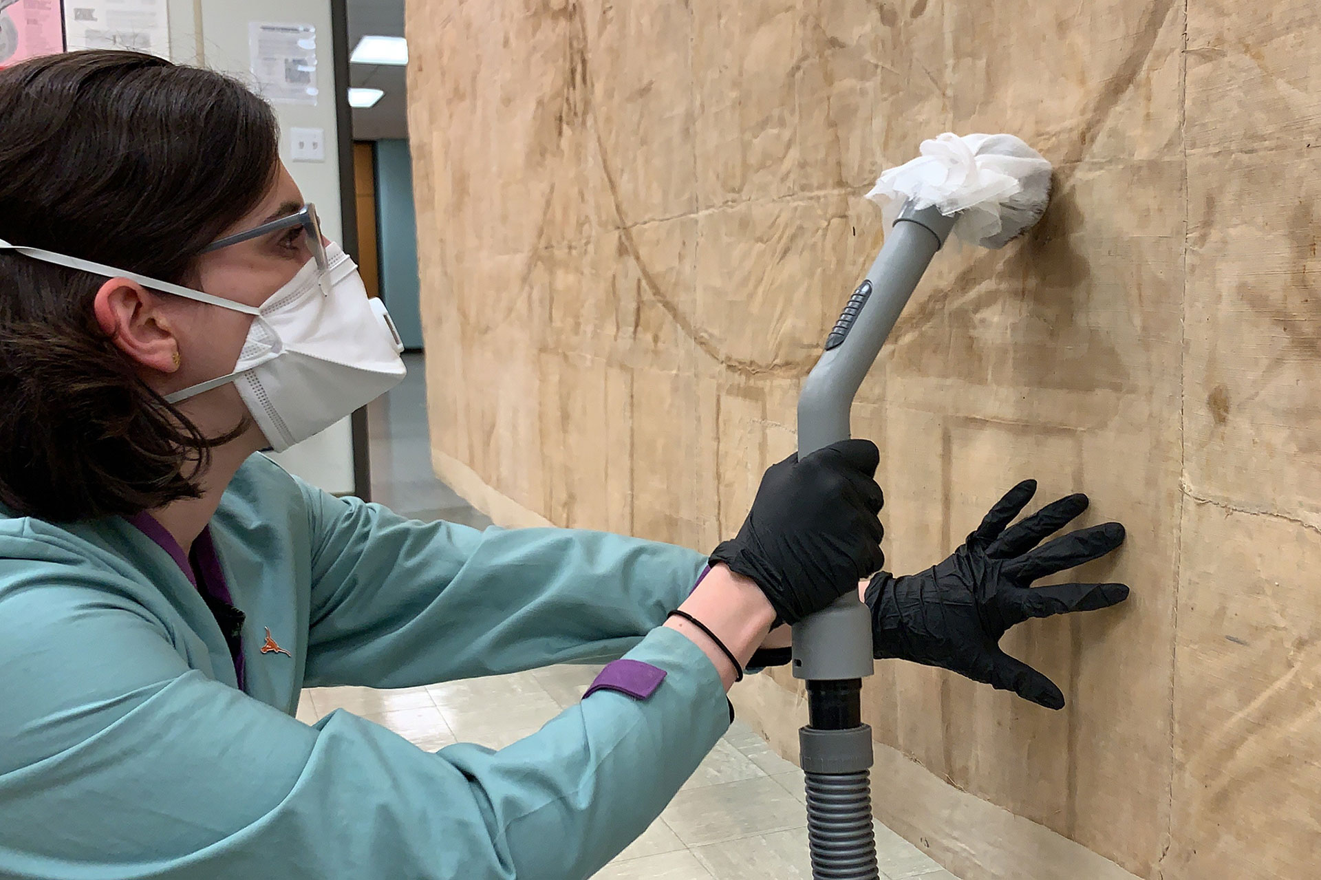
Once the paper was stabilized, we surface-cleaned the fabric lining on the back of the map with a HEPA-filtered Nilfisk vacuum on low suction. This procedure removed surface dirt that had accumulated over time.

We are continuing our work on the back of the map by removing a modern hanging rod and fabric strips that are adhered overall to the top and bottom edges. The rod and strips restricted movement of the map’s paper and fabric, which subtly expand and contract in response to environmental humidity and temperature changes. This restriction in movement has resulted in undulations throughout the map. By removing the rod and strips, we hope to release some of that tension, and help the map regain its planarity.
Future treatment steps involve humidification, localized flattening, and stain reduction. As it is now, the deep creases and water stains interrupt how a viewer “reads” the map, concealing geographic labels and drawing the viewer’s eye away from the beautiful and intricate detail of the map’s imagery. By relaxing the creases and diminshing the stains, the visual continuity of the map can be clarified and the strain on its media, paper, and fabric mitigated.
Another aspect of treatment will be compensation for areas of the map that are lost. Though this map is unique in its hand coloring and edge decoration, there are other known copies of the map in various formats and states of engraving. By contacting other institutions who have these copies in their collections, and using high quality digital images of those maps, the conservation team will be able to create digitally-printed fills for the aforementioned losses.

Making sure that all areas of loss will be filled with images from the same state of engraving, they will be printed on 100 percent rag paper that is a compatible thickness and color to the map’s paper. Once printed using pigment ink, the image will be cut to the size of the loss, inserted, and attached using wheat starch paste.
Close examination will easily reveal the fill locations, and a detailed record is being kept on every treatment step so that there will be no question regarding the location of non-original materials. These materials, and all the materials used throughout treatment, were chosen for their compatibility with those used in the creation of the map, reversibility, and long-term stability.
Once treatment is complete, the map will be framed for exhibition and will remain in the frame in storage to allow accessibility for researchers. By completing this research, treatment, and framing, the Blaeu World Map project team is enabling the map to be safely exhibited in our gallery and available for study far into the future. It is an honor to be part of that journey.
Emily Farek is the 2019-2020 Kress Paper Conservation Fellow working with senior conservators at the Ransom Center.
Learn more at https://40for40.utexas.edu/giving-day/19787/department/29215.